The Giant’s Hand

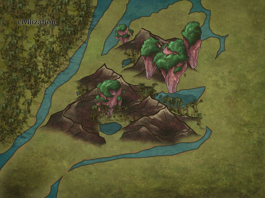
The Giant’s Hand is a rock formation consisting of a large island-like structure in the middle of a former lake, as well as several floating rocks above small ponds in its interior. It is some distance from civilization, and is the only documented area with floating rock formations.

Local legends say a great giant or god fell here. He wrenched his hand free, pulling the earth up and forming mountains. Floating rocks were formed when some of the mountains were pulled up so far that they came free of the ground. The space beneath them was then filled in by water over the years of rainfall.

There is no evidence that gods are real or visited this site, thus necessitating a scientific explanation. Floating rocks have been theorized as the result of magnetic repulsion, detailed here. The formation itself happens to look like a large handprint, but was most likely just a mountainous formation that happened to occur in the midst of a prehistoric lake.

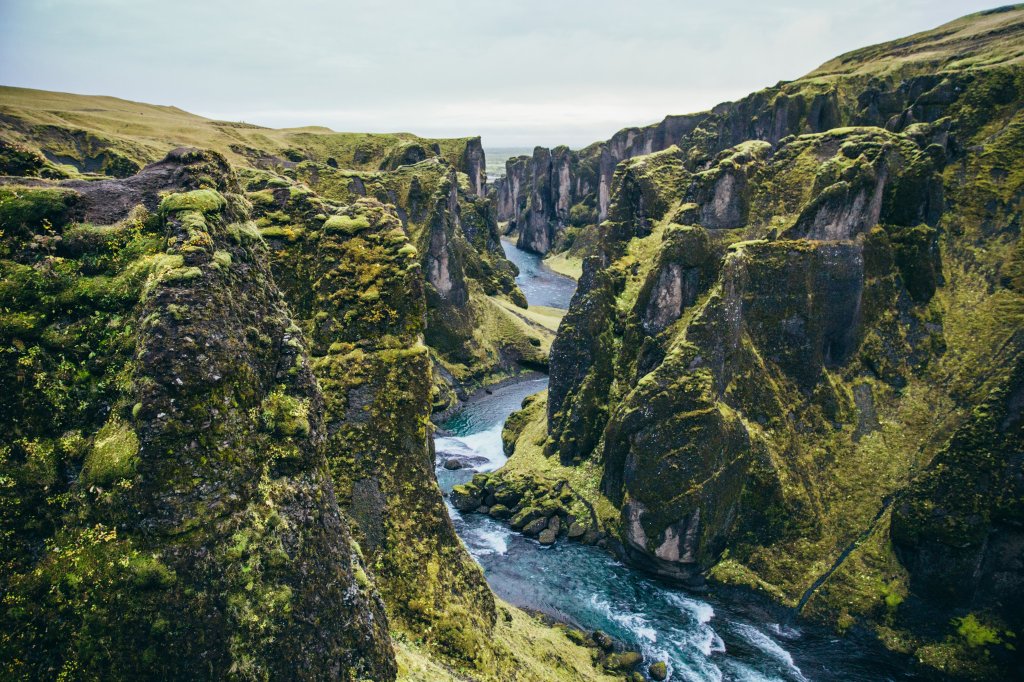
The existence of the lake and the odd way the water moves around the mountains suggests that there is a network of underground rivers beneath or around the mountains. While some claim this supports the theory that the range was formed by a god, it is more likely that earthquakes, wear from the water itself, and other stressors created underground rivers that change the way water moves around the mountains.

One theory, found in an ancient human textbook from long before humans had interacted with the other races, suggests that mountains are formed by internal stressors in the ground, possibly the same stressors that created the underground waterways. This theory says that the ground is formed in plates of rock that sometimes collide or slide against each other, forming mountains.

Most inhabitants of the Giant’s Hand live on the floating rocks. They are typically Vuzodep, and spread the legends and histories of the area verbally. Notably, their history does not mention ever residing in the country Vuzode, from which the Vuzodep people get their name. While ponds, rivers, and lakes provide ample fresh water, growing food can be a struggle as the locals must find ways to grow food atop their floating rocks or must travel to the surface to gather.

Early Flight?

Photo by MEUM MARE

This is one of the earliest images in our archive. It seems to be depicting a mountain range from above, as if from a bird’s view. This may be a fanciful image by the artist, though images from our own experimental flights show that it is remarkably accurate in terms of viewpoint and angle. It also seems to be framed by a shiny, artificial portal of some sort. This suggests that the vantage point may have been achieved by some sort of spell.

It is also possible that flight was achieved at an earlier time, and that the technology was somehow lost to time. This is consistent with some salvaged pieces made from a material that resembles the shiny white frame of the window.

One final thing of note; the image is not consistent with any known mountain range on ‘El’.

Druid Circle of Venom

Dwarves are rarely druids since they feel a stronger connection to the earth and the mind, but there is an exception in the area the bandeargen call the Eresse Mountains. These dwarves communed with the magic spiders in the woods to learn venom magic.

When the elves found the dwarves, they believed they were a threat and drove them out of the woods. The dwarves were forced to flee to the lakes below. Now they practice venom magic with the jellyfish in the lakes while elves protect the forests.

Photo by Alice Alinari on Unsplash

Image by Stefan Keller from Pixabay

The Kre caves were named after a powerful earth moontouched named Kre Karson who built them using his komorebi to create passageways through the many rock formations in the Grayrock Canyon. Each cave is just a short passageway rather than a dead-end cave. When asked why they’re completely square, he told them sarcastically that if they wanted pretty caves, then they could use their own komorebi to come down and smooth out every single rock.

Copperdust Mountains

The Copperdust Mountains are aptly named for the reddish clay that’s found there. There are traces of copper in the clay that lead to a beautiful and unique look for the local dwarves’ sun-dried pots, which are famous amongst other dwarven strongholds.

Photo by Emanuel Hahn from StockSnap

Kellytown

https://burst.shopify.com/photos/mossy-cliffs-by-glacier-springs?c=around-the-world

The town of Kellytown is at the top of a mountain. There is a river on the outskirts of town where the citizens love to swim. It is the ancient home of a group of dragons, and the black dragon returned here to lay her eggs for many years. The dragonriders and dragons frolicked in the waters, jumping off the cliffs into the deep pool at the mountaintop without hesitation, just as the townsfolk always have. The river is unique because the large river is fed by a spring that comes out of the ground, forming a deep pool at the top of the mountain from which the rives flows.